The British had experiences with Nepal in the “Gorkha War” fought between the Ghorkhali Army and the East India Company from 1814 up to the Treaty of Sugauli in 1816. Both sides had pursued ambitious expansion plans for the mountainous north of India. The EICo in their usual vein, had been trading with Nepal from around the mid-eighteenth century, in commodities made up mostly of rice, butter, oil seeds, timber, dyes and gold. Things were going swimmingly until the Gorkhas, in 1768, conquered the Kathmandu Valley and became the ruling force in Nepal. Prithvi Narayan Shah, founder of the house of Ghorka, saw the need to unify the existing 54 states into one territory, something he managed with success over a few years. (When the EICo referred to “Nepal” they were in fact, only referring to the Kathmandu Valley).
The ruler of the Kathmandu Valley, Jaya Prakash Malla, implored the EICo for assistance against Shah, but the expedition – the Kinloch Expedition – misfired and Kinloch never reached Malla. The conquest of the Kathmandu Valley by Prithvi Narayan Shah initiated with the Battle of Kirtipur, led to the relocation of his kingdom’s capital from Gorkha to Kathmandu. This expansion marked the establishment of the empire that would be recognized as Nepal, built by him and his successors. Additionally, the invasion of the prosperous Kathmandu Valley provided the Gorkha forces with the necessary economic resources to pursue their military objectives across the region.
Conversely, aggressive incursions into Tibet, stemming from a protracted dispute over trade and control of mountain passes, prompted intervention from China. In 1792, the Qianlong Emperor of China dispatched an army that forced the Nepalese to retreat to within 5 kilometres of their capital, Kathmandu. Acting Regent Bahadur Shah, the younger son of Prithvi Narayan, sought assistance from the British Governor-General of India. Eager to avoid conflict with the Chinese, the Governor-General refrained from deploying troops and instead sent Captain Kirkpatrick as a mediator. However, by the time he arrived, the conflict with China had already concluded.
The situation in Tibet delayed a planned offensive against the Garhwal Kingdom, but by 1803, Raja Pradyuman Shah of Garhwal was ultimately defeated. He lost his life in the conflict in January 1804, resulting in the annexation of his territory. Further to the west, General Amar Singh Thapa expanded his campaign, capturing lands as far as Kangra in Himachal Pradesh and laying siege to its formidable fort. Nevertheless, Maharaja Ranjit Singh, the leader of the Sikh state in Punjab, intervened and successfully pushed the Nepalese forces east of the Sutlej River by 1809.
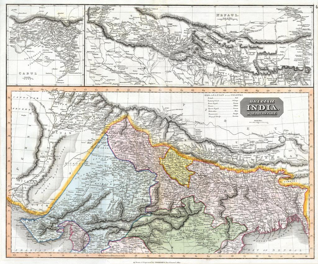
In the years preceding the Anglo-Nepalese War, the British were actively broadening their sphere of influence. Concurrently, the Nepalese were extending their empire into Sikkim to the east, Kumaon and Garhwal to the west, and Awadh to the south. Meanwhile, the British East India Company was solidifying its presence in India, primarily from Calcutta, Madras, and Bombay. This particular expansion faced significant resistance, highlighted by three Anglo-Maratha wars and the ambitions of Ranjit Singh and the Sikh Empire in the Punjab region.
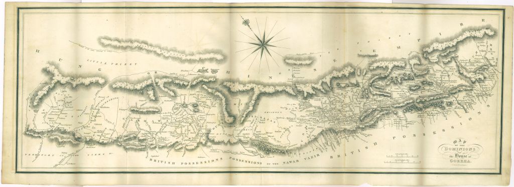
Territorial disputes were a major factor contributing to the outbreak of the Anglo-Nepalese War. Initially, the differing perspectives on borders and territoriality between Nepal and the British East India Company created significant tensions. Borderlands were defined as “zones of contact for the management, separation, and negotiation of difference,” and before 1814, disputes over these areas were crucial in escalating hostilities between Nepal and British India. Historically, the Himalayas have been characterized by political fluidity and complex agrarian rights, resulting in Nepal’s boundaries being notably permeable. Rather than adhering to rigid territorial demarcations, Nepal operated within an unbounded space that allowed for diverse movements of trade and population. The administration of Nepal’s borders frequently changed, influenced by environmental factors, claims of tribute and taxation, and patterns of landholding. Consequently, control over the Anglo-Gorkha borderlands—Nepal’s frontiers with British India—often shifted among various authorities. In the eighteenth century, these borderlands became a significant concern for the British, who perceived borders as fixed and unchangeable, interpreting Nepal’s dynamic boundaries as intrusions into British territory. Driven by territorial anxieties, the Company initiated surveys and mapping endeavours. These efforts aimed to delineate political and administrative boundaries within Nepal, making the territory “more legible for colonial rule.” The maps produced by the Revenue Surveys in the nineteenth century were part of a strategy to categorize land into distinct, non-overlapping areas. Thus, the conflicting notions surrounding borderlands and spatial organization were pivotal in escalating territorial disputes, culminating in the onset of the Anglo-Nepalese War in 1814.
As 1814 approached, the British believed the Gorkhas were planning to ally themselves with the Sikhs in northern India and came up with a plan to expel Nepal from the Terai – their Western lands – and thus secure themselves from this particular threat. As such, they set out to do exactly that; and in 1814, Lord Moira, (Francis Edward Rawdon-Hastings, 1st Marquess of Hastings) then Governor General of Bengal, declared war on Nepal.
